Interactive Map Shows Hudson Valley Internet ‘Dead Zones’
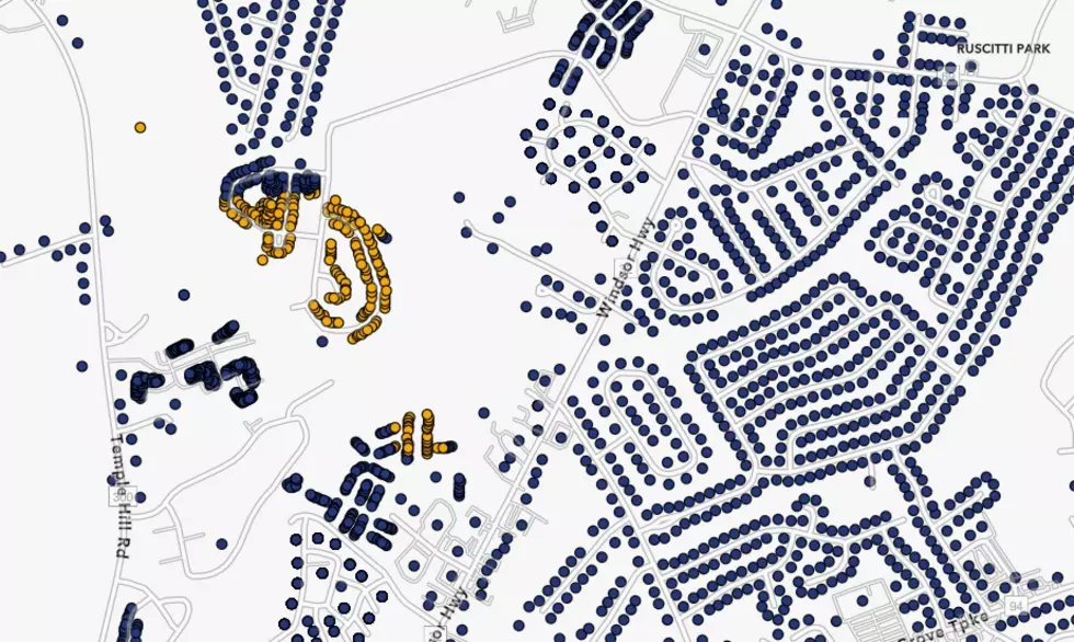
If you're searching for a home or just want to snoop on your neighbors, a new map shows you how much Internet is available at any Hudson Valley address.
Governor Hochul unveiled a "first-of-its-kind" database of the state's broadband infrastructure. You may remember receiving a survey about the quality of your Internet service. Responses from tens of thousands of New Yorkers coupled with data received from the states' Internet service providers pinpoint where broadband service is available and where residents are still surfing the web like it's 1995.
Luckily, much of the Hudson Valley appears to have plentiful access to high-speed Internet service. Broadband is currently available to 96 percent of Dutchess County residents, with just over 4,000 residents left without service. In Orange County, high-speed Internet is in 96.6 percent of addresses with about 4,000 homes not being served. Ulster County has the best coverage of broadband with 97 percent of the county covered by fast Internet. Only 2,500 Ulster addresses are without service.
These "dead zones" are not in places you may expect. Low-income areas in Poughkeepsie, Newburgh, and Kingston all show impressive coverage, with almost every address having access to broadband. Most of the unserved areas are comprised of apartment complexes, townhomes, and rural neighborhoods that have been left off the grid.
College dorm rooms also make up many of the living units listed as "unserved." However, those students generally do have access to high-speed wifi coverage throughout most of their campuses.
We found that many of the neighborhoods with large numbers of unserved homes are actually new developments that utility companies have not yet had a chance to hook up yet.
For those searching for a home in the Hudson Valley, the map is a great resource that allows house hunters the ability to check out Internet speeds before considering a property. For many, broadband access is a must-have utility, just as important as water or electricity.
You can view the interactive map on the New York State Department of Public Service's website.
5 Outstanding Hot Dog Stands in the Hudson Valley
7 'Gotta Get To' Hudson Valley Flea Markets
More From WPDH-WPDA


